.png)
.png)
.png)


.png)
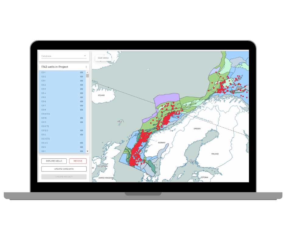
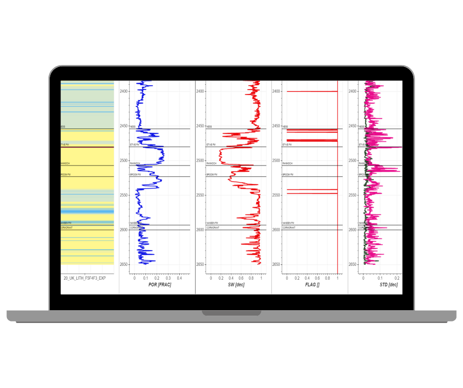
Harmonised, searchable subsurface data
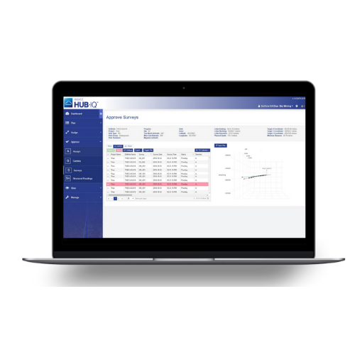
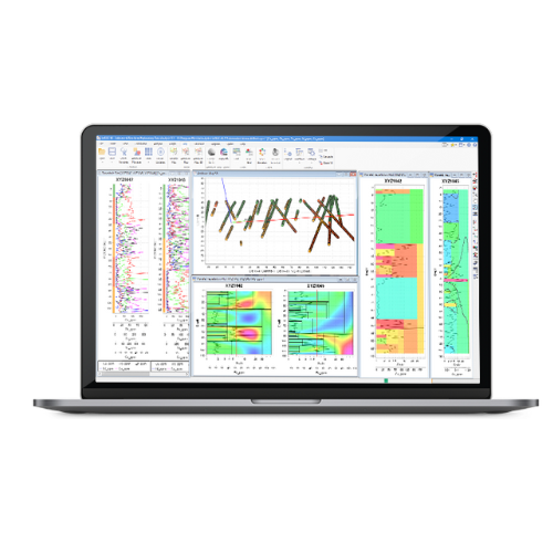
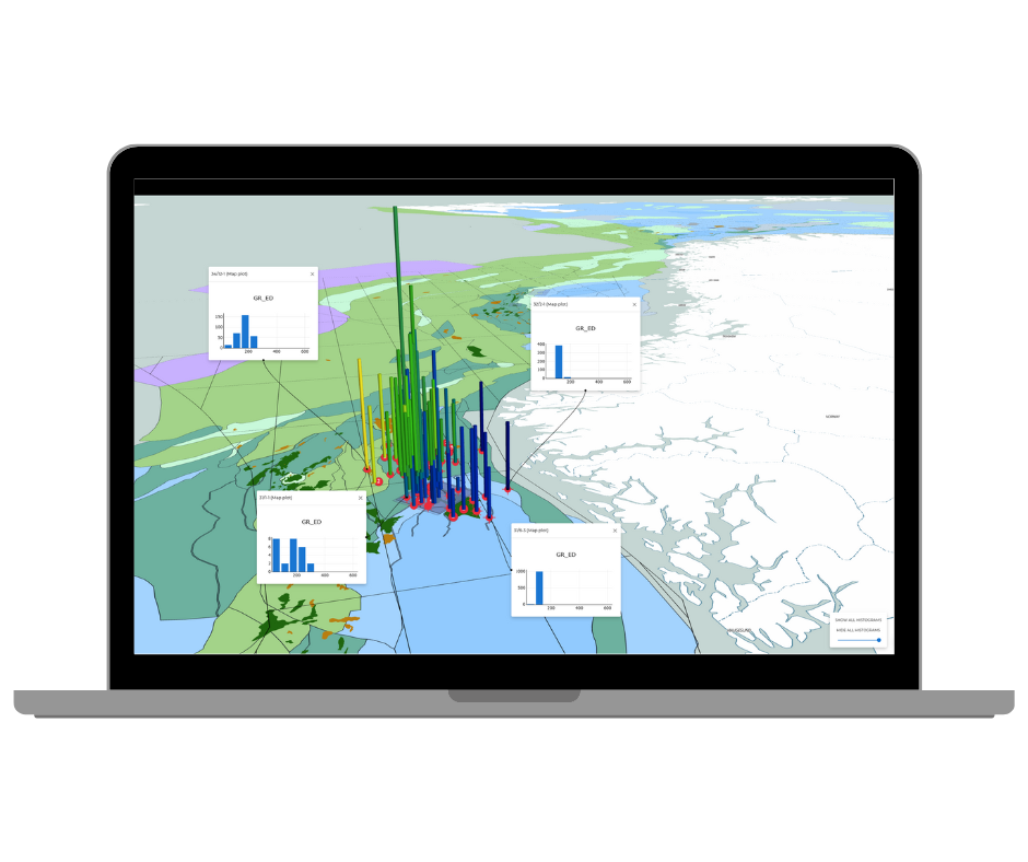
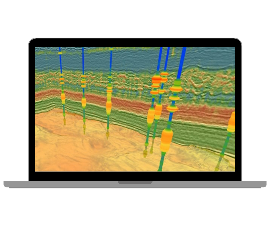
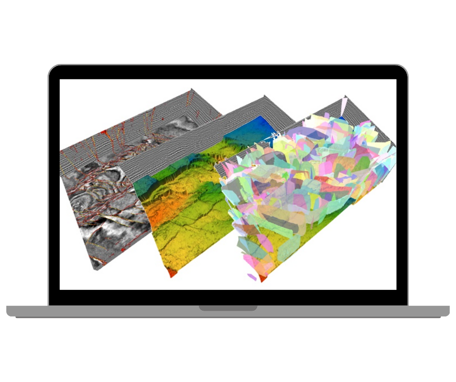
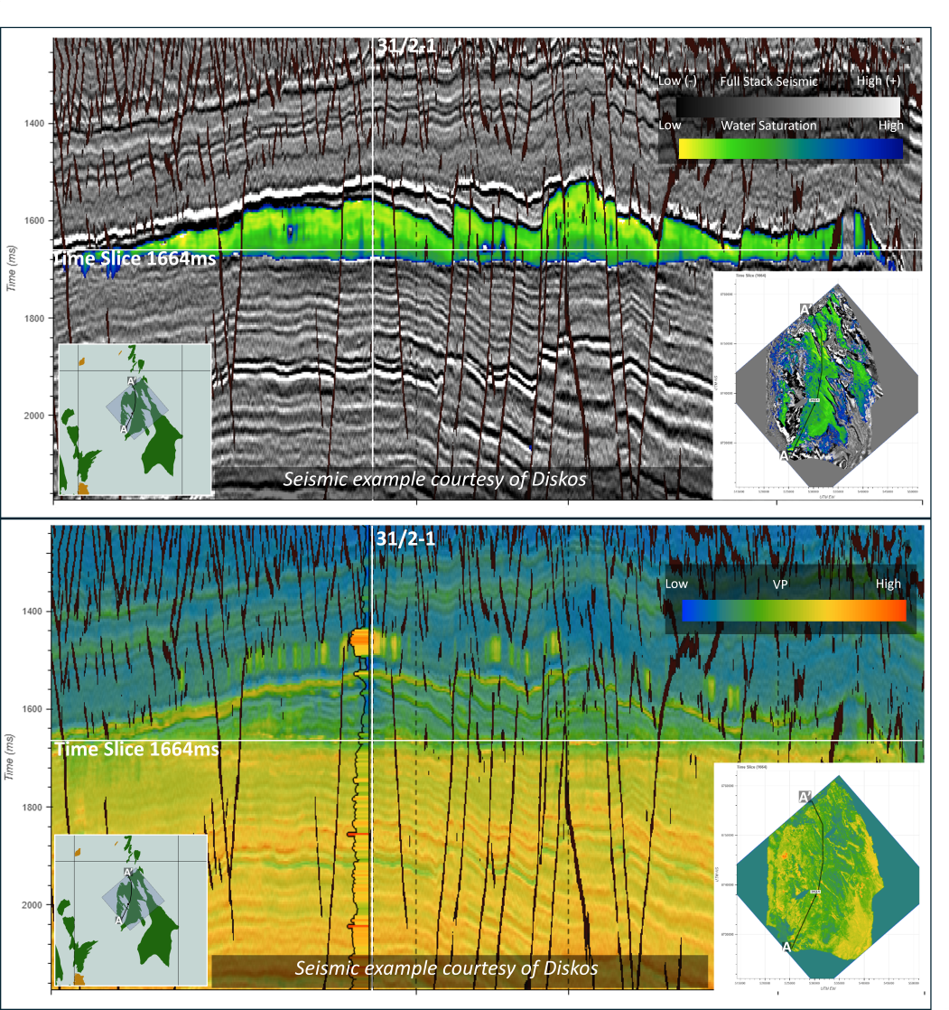
Browser-based 2D/3D visualisation
AI-assisted interpretation workflows
Rapid property prediction
OSDU™ and legacy data integration
Secure, scalable cloud platform
Solving your challenges through science, technology and people
EarthNET brings subsurface data, visualisation, and AI into a single connected workflow—helping teams spend less time preparing data and more time making confident, business-driven decisions.
Faster insights: Reduce cycle time by accelerating interpretation and property prediction with AI-assisted workflows.
More consistent outcomes: Improve repeatability across teams by governing data, models, and workflows.
Better use of existing data: Integrate seismic, well and image datasets so information can be compared and analysed together.
Interoperability by design: Connect with OSDU™ and existing data sources to avoid duplication and reduce siloed work.
Enterprise-ready delivery: Cloud-native approach that supports collaboration, scale and controlled deployment.
-
AI for offshore geoscience
-
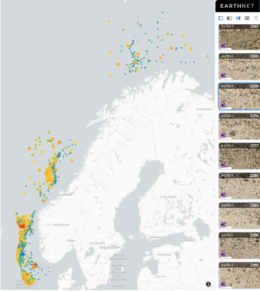
Unlocking well data with AI
-
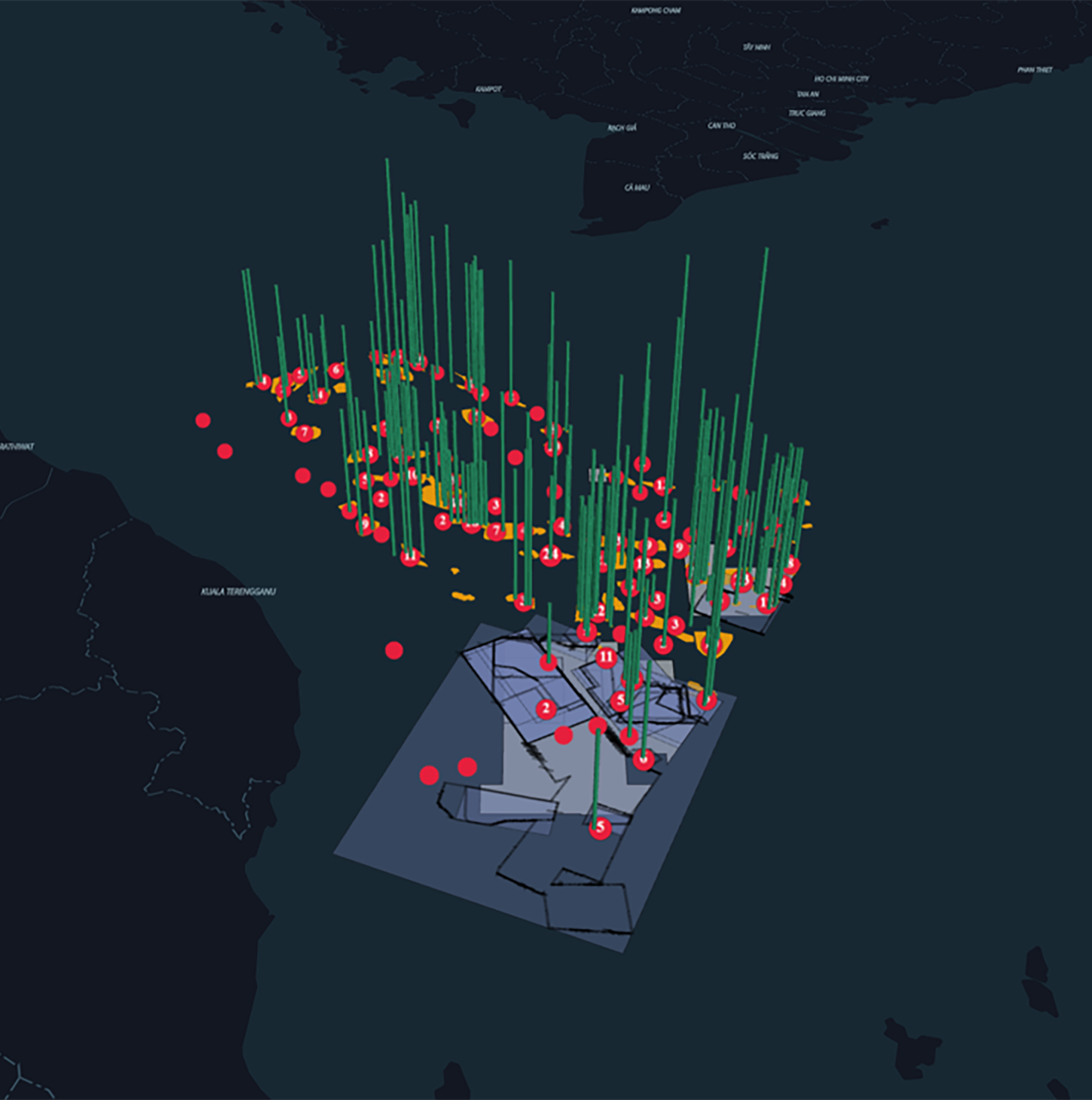
AI-driven subsurface insight in Malaysia
-
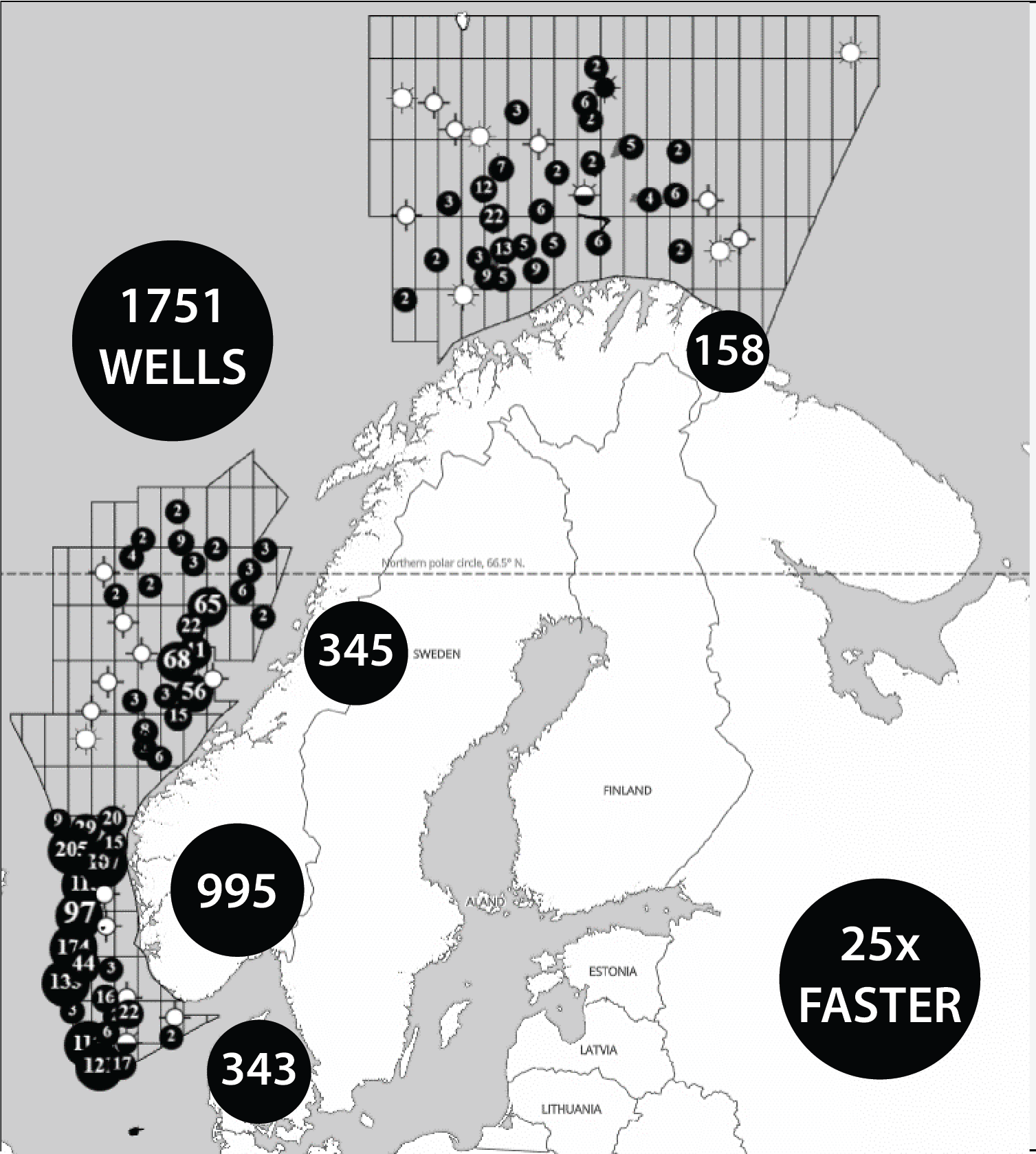
From cuttings to clarity: Norway
Liberating data and innovating workflows
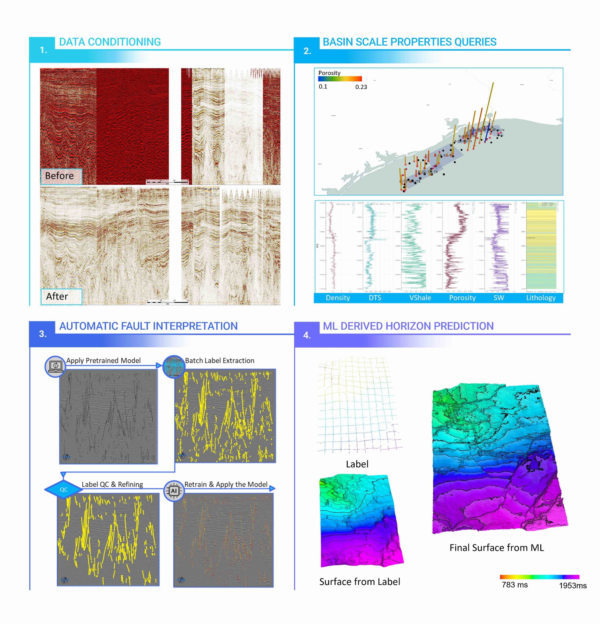
The EarthNET suite of tools enables the use of all available data to gain a more complete geological understanding and optimise decision-making related to drilling exploration wells, developing CO2 storage sites, and siting wind farms. The powerful AI technology allows you to uncover hidden insights in your data, identify trends, patterns and correlations that were previously impossible to see.
-
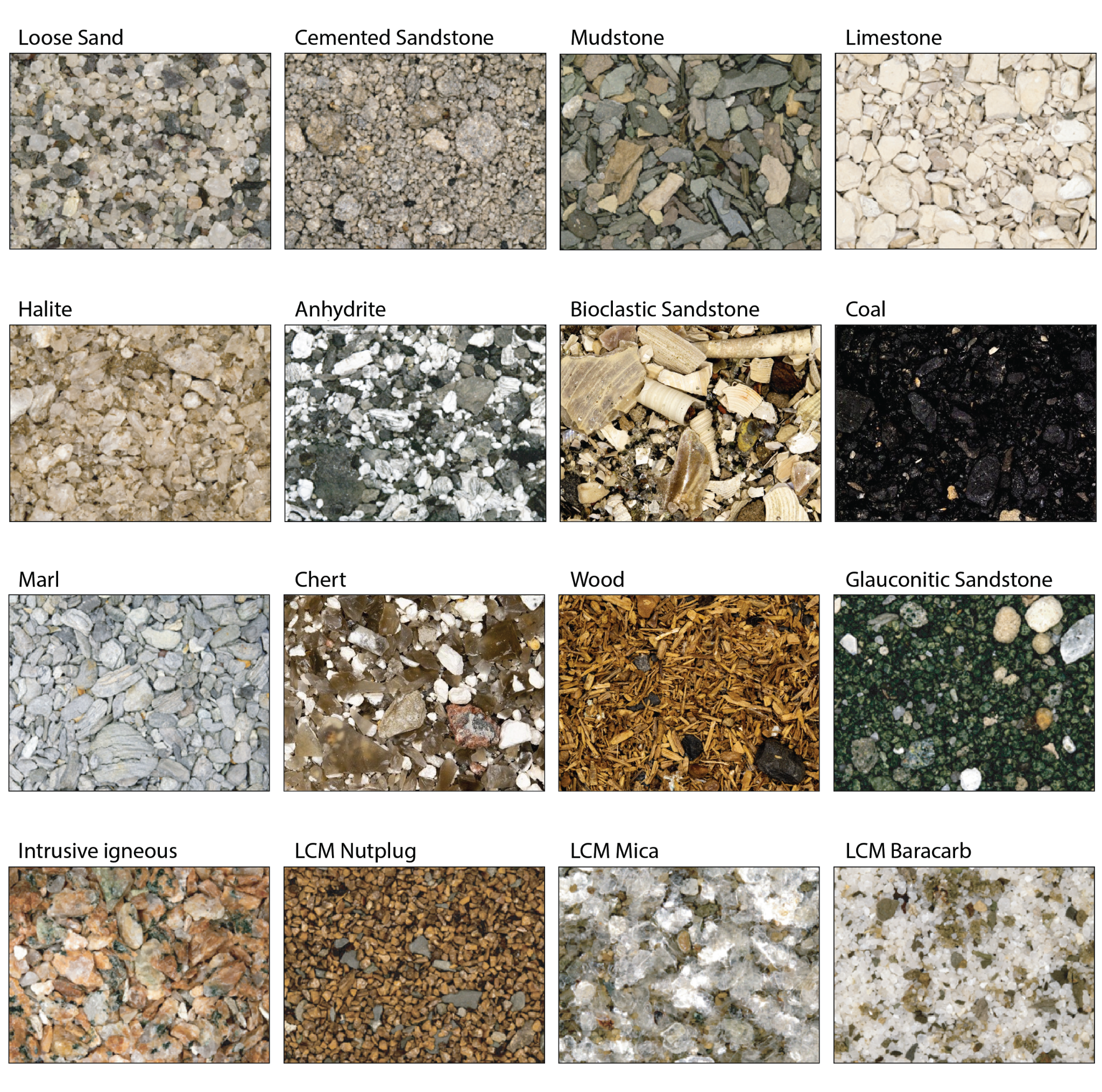
Computer vision for cuttings analysis
-
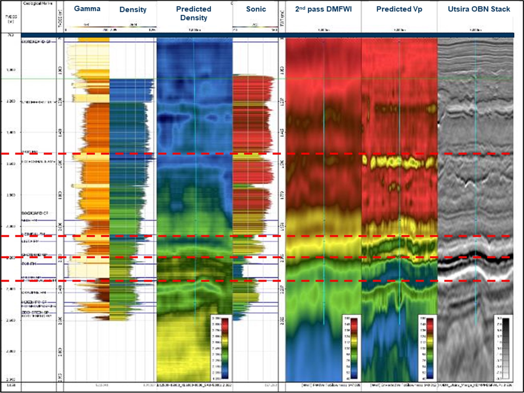
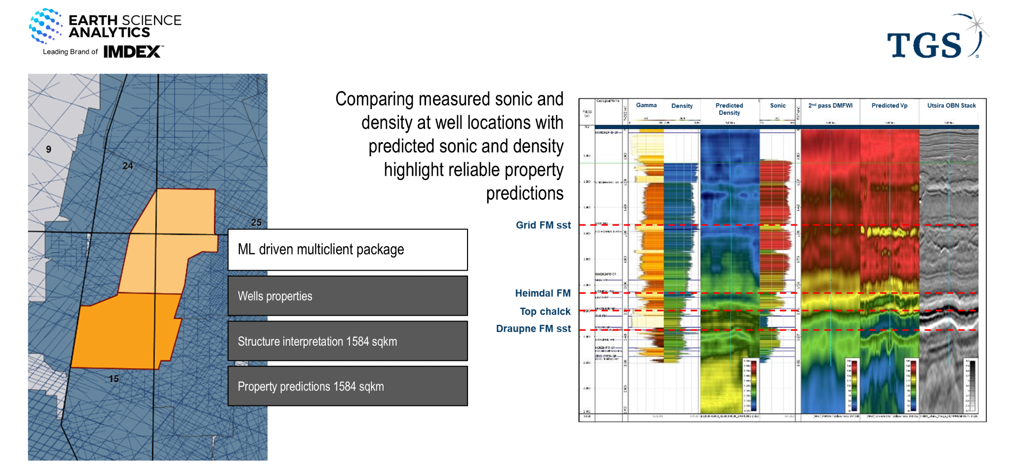
Combining AI with Utsira OBN survey
-
Characterising carbon storage sites ith AI
-
Predicting hydrocarbons in wells using AI
-
The value of AI in cuttings interpretation
-
Digital brains for understanding phyiscal grains
-
Fast Multiclient Data Delivery for Energy of the Future TGS collaboration
Frequently asked questions
Q1. What is EarthNET?
A. EarthNET is ESA’s cloud-native platform that brings together a Data Lake (ingestion + contextualisation), a browser-based Viewer (visualisation), and AI applications that scale interpretation and prediction—helping teams move from data hunting to decision-making.
Key capabilities
Import and contextualise data from OSDU™, legacy databases and folders
Visualise well, seismic and image data with map-based exploration
Support reproducibility with version control and model libraries
Q2.What can EarthNET’s AI applications do?
A. EarthNET provides AI workflows that reduce cycle time and improve consistency—using pre-trained models where it makes sense, and project-specific training where it matters, with uncertainty outputs to support risk-aware decisions.
AI applications
AI Seismic Interpretation: Faster faults, horizons, geobodies and stratigraphic interpretation
AI Seismic Properties: Predict target properties from seismic and well data using supervised learning
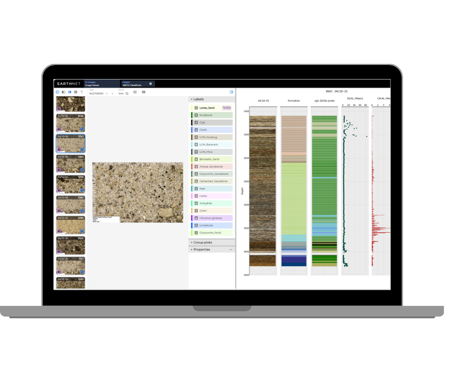
AI Images (Computer Vision): Classify, detect and segment geological imagery without coding
AI Wells: Clean data, infill missing logs, and predict properties from well/log/core/fluid data
Q3. How does EarthNET integrate with existing systems?
A. EarthNET is designed for interoperability—supporting rapid ingestion across sources and formats, then contextualising datasets so different data types can be analysed together without creating another silo.
Integration highlights
OSDU™ integration to enable push/pull interoperability
Cloud-agnostic deployment options (to suit your environment)
Designed to complement the broader IMDEX digital ecosystem over time
Q4. What outcomes can EarthNET help deliver?
A. EarthNET is positioned as a strategic digital platform to accelerate integrated workflows—supporting faster decisions, better use of data and improved productivity across projects.
Reported outcomes (indicative)
>90% reduction in geophysical interpretation time (weeks to hours)*
>95% accuracy in rock property prediction using AI models trained on QC’d data*
Earlier intelligence from integrated seismic + multi-physics to support targeting
*Results vary based on dataset quality, scope and workflow maturity.
Q5. What support is available to help teams adopt EarthNET?
A. ESA provides domain experts and applied AI support—from data readiness and workflow design through to deployment and change management—so teams can realise value sooner and continue improving.
Contact our software experts.
Tell us what data you have, what decision you’re trying to make, and where cycle time is hurting you. We’ll show you how EarthNET can turn your subsurface data into a scalable, decision-ready advantage.